News
Powerful, enormous Earl bearing down on East Coast
By: cnn.comPosted On: 09/02/2010 11:58 A
Tweet
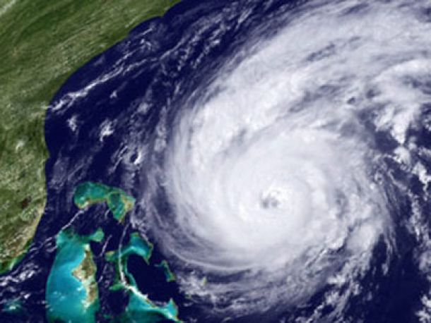
Larger than the state of California, Hurricane Earl prepared to take a swipe at the Eastern Seaboard on Thursday as residents scrambled to ready themselves ahead of its arrival.
Larger than the state of California, Hurricane Earl prepared to take a swipe at the Eastern Seaboard on Thursday as residents scrambled to ready themselves ahead of its arrival.
Hurricane warnings and watches stretched from North Carolina to Delaware, and covered parts of Massachusetts.
President Barack Obama signed a disaster declaration for North Carolina Wednesday evening. The action authorizes the Department of Homeland Security and the Federal Emergency Management Agency to coordinate relief efforts, and also makes federal funds available to states. Maryland's governor issued an emergency declaration earlier in the day.
The monster storm is forecast to pass close to North Carolina's Outer Banks on Thursday night, the National Hurricane Center said. It is expected to take aim at southeastern New England on Friday night. The storm's track shifted slightly to the west, closer to North Carolina's Cape Hatteras. The National Hurricane Center has posted storm watches and warnings for areas as far north as Maine
Officials in Dare County, North Carolina, issued mandatory evacuation orders Thursday for visitors to the coastal county, including the Outer Banks. The mandatory evacuation extended to residents in some areas, including the town of South Nags Head and Hatteras Island. Dare County schools and courts were closed Thursday and will be closed Friday.
"Residents along the oceanfront are advised to relocate due to coastal flooding and ocean overwash that will occur," the county said in a statement.
"Residents of Dare County have been through this many times," the county's emergency response coordinator, Warren Judge, told CNN's "American Morning." "And they have their own individual practices and procedures to get their homes and businesses secured and prepared for the oncoming storm. What we need to happen now is for the visitors to heed the warning, to evacuate."
As of 8 a.m., the center of Earl was located about 355 miles (570 kilometers) south of Cape Hatteras, North Carolina, and about 820 miles (1,320 kilometers) south-southwest of Nantucket, Massachusetts. It was heading north-northwest at about 18 mph (30 kph).
Earl is a Category 4 hurricane with maximum sustained winds of near 145 mph (230 kph) and gusts up to 175 mph. It is also a large storm, meaning effects will be widely felt even if it does not make a direct hit.


Latest VLogs

iLoveMakonnen "Loudest of the Loud Tour - On the Road Pt. 2"

Life With Ty Dolla $ign (Ep. 7)
